
Walk: Map:
Start Point: Date: Download Track: |
Long Mynd, Shropshire Explorer 217 11.1 miles SP 44628 94400 June 2008 |
We parked in the National Trust Pay and Display car park on a bright and warm May day.
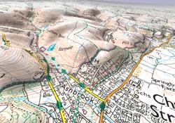
Walking west and following the short, but sharp ascent of Carding Mill Valley, we were rewarded with spectacular views back down the valley to the town of Church Stretton, and in the distance, Clee Hill to the south-east. We continued to climb gently through the short grass and scattered gorse bushes until we had clear views of the Stiperstones to the east.
The descent to the valley to the west was equally rewarding with some good walking and ample photo-opportunities. Following the course of the river East Onny for some way, we headed towards Bridges. Although there is a public house in the village, lunch was taken on the side of a hill, with a forest behind and a small, babbling brook below.

With lunch over, we started to climb past Manor House, Shaw Wood and on to Wild Moor, re-acquainting ourselves with the spectacular views of the Shropshire hills. Finally, on what became a very hot afternoon, we descended Carding Mill Valley to the car park and to a most welcome pot of tea in the National Trust café.